Langstone Village and Harbour: Mill, Bridge and Tide Safety
Langstone sits where the Hayling road crosses the harbour. Here is its history, the mill and bridge, the National Landscape, and how to stay safe around the tide.
Langstone is a harbourside village just south of Havant where the A3023 crosses Langstone Bridge to Hayling Island; its shore is part of Chichester Harbour National Landscape, and the Conservancy says its shoreline walks flood at high tide in places, so check tide times first.
What is Langstone?
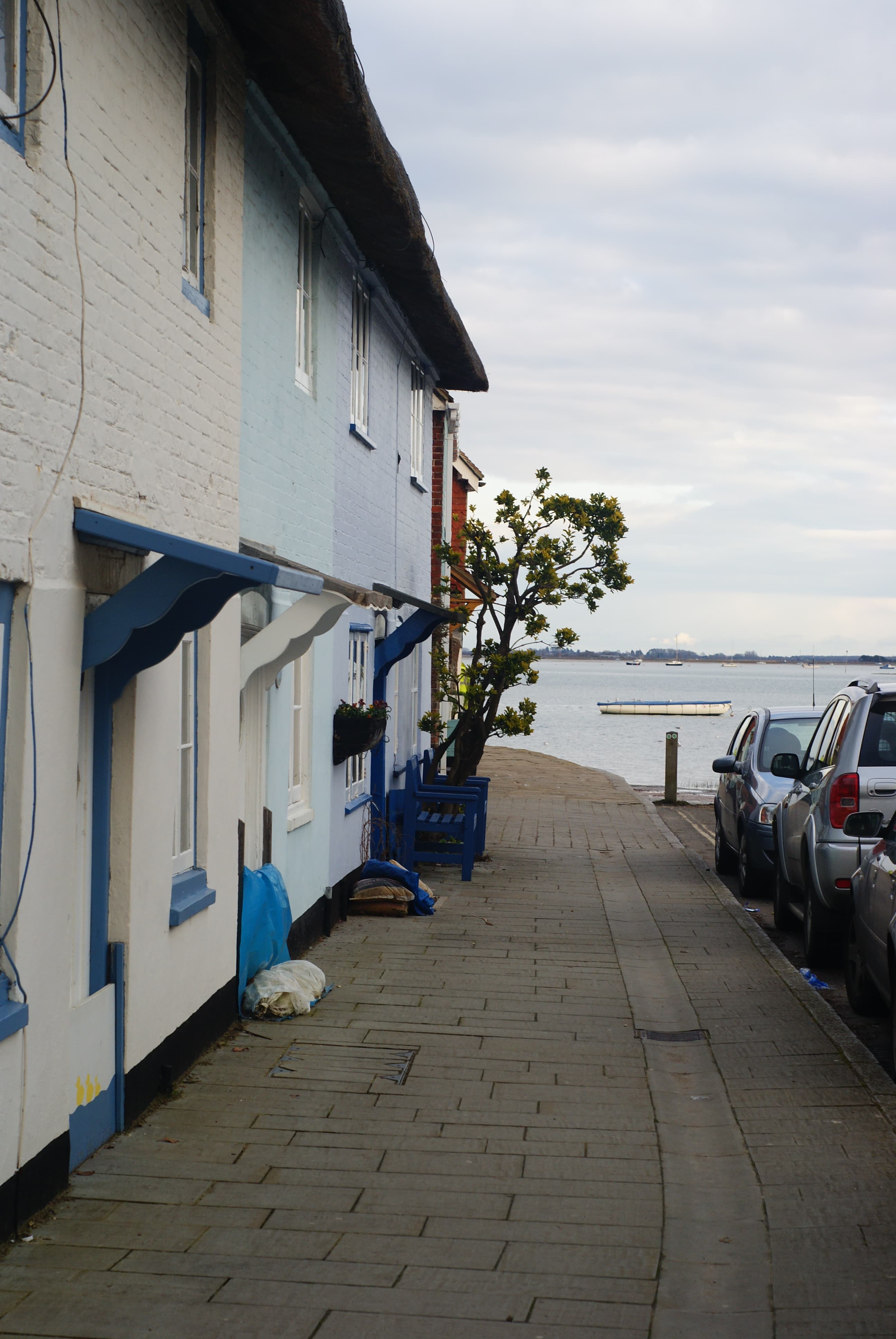
Langstone is a small harbourside village just south of Havant, at the point where the road to Hayling Island crosses the water. Wikipedia describes it as a village near Havant with a sailing club and several historically significant buildings, including a converted water millhouse and a converted 18th century windmill, the latter a local landmark. It says the High Street is a Conservation Area, marked by a blue plaque at the sea end, and that Langstone Road leads to Hayling Island. Many older buildings on the High Street have slots for flood boards, which is a useful clue that this is a village that lives with the tide.
What is the story of Langstone Mill?
According to Wikipedia's article on Langstone Windmill, the Grade II listed tower mill was built around 1730 and worked in conjunction with a tide mill close by. It was derelict in 1934 and by 1939 had been converted to residential accommodation, with the artist Flora Twort as the first resident. The article lists its operator as private, so view the mill from the public paths and the road rather than expecting to go in. The Langstone page adds that the writer Nevil Shute Norway lived at the old mill in 1939 before moving to Hayling Island.
What is Langstone Bridge?
Langstone Bridge carries the A3023 over the harbour channel to Hayling Island. Wikipedia's Langstone Bridge article says the earlier connection was a causeway called the Wadeway, which was cut by the Portsmouth and Arundel Canal, and that a wooden toll bridge followed. It says a replacement concrete bridge opened in 1956, initially still as a toll bridge, owned by Hampshire County Council and operated without tolls from April 1960. The same page says excavation of the Wadeway in 2006 put its date in the Roman to medieval range. The Wadeway is not a route to try, as the page describes it as impassable.
For crossing the bridge today, our Hayling Billy Trail guide explains the cycle and walking route that continues south from the bridge. The Conservancy's Hayling Island Cycle Route leaflet starts at the Langstone public car park next to The Ship pub, which it describes as free parking, and heads over the bridge. Both pubs we mention in this guide, The Royal Oak and The Ship Inn, are named only as landmarks on the route.
What is Chichester Harbour National Landscape?
Wikipedia says Chichester Harbour lies to the east of the old railway bridge at Langstone, and Langstone Harbour to the west. The Chichester Harbour Conservancy says the harbour was designated an Area of Outstanding Natural Beauty on 4 February 1964, and was rebranded a National Landscape in 2023. It is one of 34 National Landscapes in England and holds equal status with the National Parks in planning law. Its special qualities include the intertidal zone of mudflats, saltmarsh and reedbeds, and internationally important birdlife, with vast numbers of wetland birds overwintering in the harbour.
The Conservancy's walking page asks walkers to keep dogs under close control or on a lead and to stick to the paths, so the birds can feed, rest and nest.
Can I walk from Langstone to Emsworth?
The Conservancy lists an "Emsworth to Langstone Oysterbeds" route, a 10km shoreline walk of about 6 miles, with an extension to the Hayling Billy Line and the old oyster beds in Langstone Harbour. Its route leaflet gives about three hours and a moderate rating, and says it starts at the end of Warblington Road, PO10 7HW, where there is free roadside parking. Along the way it passes Warblington church and the old mill and pond before reaching Langstone. See our Warblington guide for the first half of that walk.
The Spring also offers a self-led route called "3,000 Years of Changing Landscapes", a circular walk around Langstone of about 3.5 miles that should take around 90 minutes and starts and finishes at The Spring. Directions are on its self-led heritage walks page.
How do I stay safe around the tide at Langstone?
The same Conservancy page says the Emsworth to Langstone route floods at high tide in a couple of places, so check the tide times before setting out. The Conservancy's weather and tides page points to 7 day tide times from the UK Hydrographic Office and gives Chichester as the standard port. We do not publish times here because they change daily.
If you are launching a kayak or small boat, the Conservancy's berthing and launching page lists Langstone Bridge as high tide access only, with a private pub car park. It also warns that at the harbour entrance the flood tide may run at 2.8 knots and the ebb at 6.4 knots at springs, which can be dangerous for the inexperienced. The Conservancy's swimming page says Chichester Harbour is not a designated bathing water, that much of it is unsuitable for swimming, and that you should never swim in strong currents or tides, which are particularly strong near the harbour entrance.
Share this article